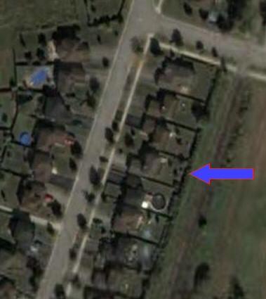
For anybody who hasn't seen it yet, Google has come out with a program called Google Earth. It uses satellite imagery to map the globe. Some portions of it have quite detailed images. It's pretty powerful stuff. Of course the first thing I searched for was my own address and luckily it has good detailed images for Beeton. You can see my house in the picture on the left (that black blob out in the end of the driveway is my Saturn!!), I added the arrow. It's also neat for going to far away places, again, some of which have very detailed images. You can see the screenshot that I took from the Grand Canyon. Somehow it also gets terrain information so you can really go into the canyon and actually look back out from the bottom of it. The navigation takes a little getting used to but once you get the hang of it it's quite fun. It can also
 superimpose roads, borders, and even lodging and restaurants! There's a lot here to fool around with. And of course the best part is that it's free. It really requires a broadband connection, but supposedly will run on just about any pc that's less than 4 years old. The power of typing in some address or town name across the globe and then watching as you zoom way way up and fly across the continents is really amazing. And it works very simply like google does. You just type in say, 'Beeton,ON' or 'Las Vegas, NV' or 'Swansea, Wales' and it just zips over there and starts zooming in. Very very neat.

No comments:
Post a Comment